Sunday, August 23, 2009

Bozeman » Salmon Lake, MT

2009-07-20: I experienced a bit of a mountainside adventure between these two points. This day started well. I found a local business that was a laundromat, car wash, and small cafe, with wireless Internet access and a large television, all at reasonable prices with well maintained equipment. I cleaned some laundry as well as my car, and was off to Salmon Lake. 

My GPS receiver told me to exit off of the interstate near a state park named Beavertail Hill. I complied, though this was about 30 miles ahead of where I planned to exit. The paved road (Cramer Creek Road) quickly turned into rutted and potholed gravel and dust. The turn I was to take was around 3 miles ahead, so I made my way slowly down the road. I came to the turn, and found it was a steep upwards slope (I would guess 20% grade), but it was only supposed to be a mile or so until the next turn. I assumed this was a shortcut, and decided to try it out. I crept slowly up the steep road as my engine put all of its torque into hauling me up the dirt path. About a quarter mile in, I came across a locked gate informing me that the road was closed. I did not want to attempt going back down in reverse, so I very carefully turned my Jeep around and went back. It was so steep that I could not use the brakes much, or I would begin to slide. There were, of course, many trees and rocks to collide with. Taking it slowly, I made it back onto Cramer Creek Road and back to the interstate.

I took the exit I had originally planned for and eventually arrived at Salmon Lake State Park. I set up camp and got a shower and went to sleep just after nightfall. I woke up sometime late that night to find the temperature had dropped to around 50° Fahrenheit. I had not been expecting that and I did not have enough blankets. That morning, a friendly Minnesotan camping nearby gave me a cup of much-needed coffee.

Travel Notes: Yellowstone National Park » Bozeman, MT

2009-07-19: I emerged from the storms that were raging through Yellowstone and found myself in Montana. The air temperature had fallen dramatically. The fragrance of pine was thick in the air left damp by the passing thunderstorms. Montana's valleys, in many places, reached as high as much of Yellowstone, but their slopes were considerably more gradual. Some of the valleys I passed through were narrow and likely dark most of the time. The beautiful Gallatin River ran alongside the road much of the way. This part of Montana is an epic place. Within Yellowstone, one often travels up close along massive walls of rock, high, dense, forests, or winding river canyons. This is impressive, of course, but in many places a bigger, wider, macroscopic overview isn't always easy to get. In Montana, one can see alpine meadows lying at the feet of mountains, and behind those mountains, more mountains, and behind those, a wide open sky. The state is sometimes nicknamed Big Sky Country, and appropriately so.

Bozeman's downtown area was quiet when I arrived on a Sunday evening. It was a pleasant place, but the big-box retail strips on he edge of town hinted that it was not long before Bozeman was assimilated into the American corporate hegemony.

I stayed there for the night, and loosely planned the next part of my journey.

Yellowstone National Park: Day II, Part II


Monday, August 17, 2009

Yellowstone National Park: Day II, Part I

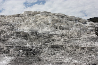
2009-07-19: I awoke early the next morning and was pleased to see that I had not received a ticket or citation for parking overnight. I checked if any trails were suitable for a day's hike, and if I would still be able to see all of the famous landmarks in the park after hiking. I decided I would not be able to see all that I wanted to unless I omitted any back country hiking, and I did not want to try my luck with the park authorities (and possibly lose my national pass!) by staying another day. Later, on the way out, I noted that the camps were all still marked as full, so waiting for an open camp was not an option. There were many small things to see - a roadside waterfall here or there, a bald eagle perched atop its nest, colourful flowers lining the highway… But I had a map and a few things in mind, and with a little hustling I was able to get to nearly everything. Some of the things I saw included an eruption of Old Faithful, and its surrounding geysers and hot springs (many of which contained boiling water!), the Norris Geyser Basin (where my favourite geyser, the Green Dragon Spring, which hisses and roars and blows steam, can be found), Mammoth Lake, Upper and Lower Yellowstone Falls, and of course, the Grand Prismatic Spring. When I had arrived at the Grand Prismatic Spring, dark storm clouds came roaring over the mountains. The thunder echoed off their stone peaks across the valley. I made my way out of the park through the storm, bound for the green valleys of Montana.

Friday, August 7, 2009

Yellowstone National Park: Day I

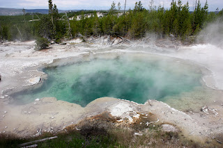
2009-07-18: As I approached the park's general region, the terrain had returned to being desert shrub-land. The town of Cody was the gateway to the park and marked the beginning of the climb back into the mountains. The highway followed the Shoshone River's North Fork, sometimes along the sides of the steep canyon it had carved, but more often along its bank. I was excited to arrive at Yellowstone. Sadly, as I approached the entrance, I was confronted by a wooden sign which informed me that every campground in the park was full. I spoke with a ranger there, and was offered Western Yellowstone (in Idaho) as an option that "might" have available campsites. I also discovered that this was a national fee-free weekend, which was likely the reason everything was full. I decided to enter the park and then I would decide what to do. I traveled some twenty miles to get to the first main "town" in the park, on the shore of Yellowstone Lake. The drive there brought forth more and more anticipation as I entered the high forests and looked down into the mountain valleys. The curves and grades were a bit more pronounced than what I went over in Bighorn National Forest. This road wound around the lake and slowly descended to its surface level. I stopped to visit some of the nearby hot springs. These are strange places. The boiling acidic water kills any plant life it touches. The pools emit an a hot steam that smells of sulfur and other minerals I cannot identify. Shortly afterward, I ended up parking my car at the campers' registration center and spending the night in the back seat.

Monday, August 3, 2009

Travel Notes: Bighorn National Forest » Yellowstone National Park

After coming down from the mountains, I dipped into a summery valley of tree lined rivers and vacationing anglers and followed the road along the river. The land gradually became hotter and drier and faded into a wasteland of drab rocky soil and little plant life. Apparently, oil can be found beneath this parched land; pumpjacks in the distance continued their ceaseless reciprocation. In the less rocky places, wheat was being grown. It looked like most other land that could be used was grazing land. On a side note, I noticed that when a large machine, like a tractor or a car, breaks in rural Wyoming, you simply find some empty land, of which there is an abundance, and abandon it. Over time, it will be joined by other failed or worn machines and left to rust.

Bighorn National Forest, WY

2009-07-18: The roadside signs indicated that US Route 16A had the lowest grade and was the safest route to Yellowstone. I did not care much about that, but subsequent signs informed me that it was the most scenic and shortest path. Traveling along this highway, I came into Bighorn National Forest, and I was stunned. This was my first time traveling on a serious mountain road. Slopes descending hundreds of feet and winding turns were a bit of a thrill, but it was the spectacular scenery that had me awestruck. 

This is where things started to get big. It was no longer about seeking out the interesting vistas; they were now everywhere. Beyond most every curve along the mountain road, a new view of an immense landscape loomed ahead. I began to have difficulty portraying the size of these things with my camera. Signs indicated the age and name of various rock formations, some of which were billions of years old. Try to imagine just one hundred thousand years. Imagine what humanity could accomplish in that time - or what we were doing that long ago. Multiply that by ten thousand. It is mind blowing, at least to me. You can stop and touch those very rocks, thus symbolically bridging the eons, but while doing so, take a moment to realize that all of human history is meaningless on such vast scales.

"Pulvis et umbra sumus." - "We are but dust and shadow." Horace, Odes, Book IV, Ode VII, Line 16